
Built Environment · Urban Landscapes
COOLCITY
Satellite-based tools helping European cities plan blue-green infrastructure and adapt to climate change.
Poland
Mission and inspiration
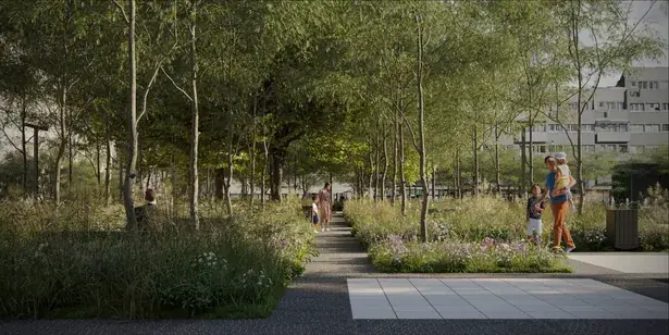
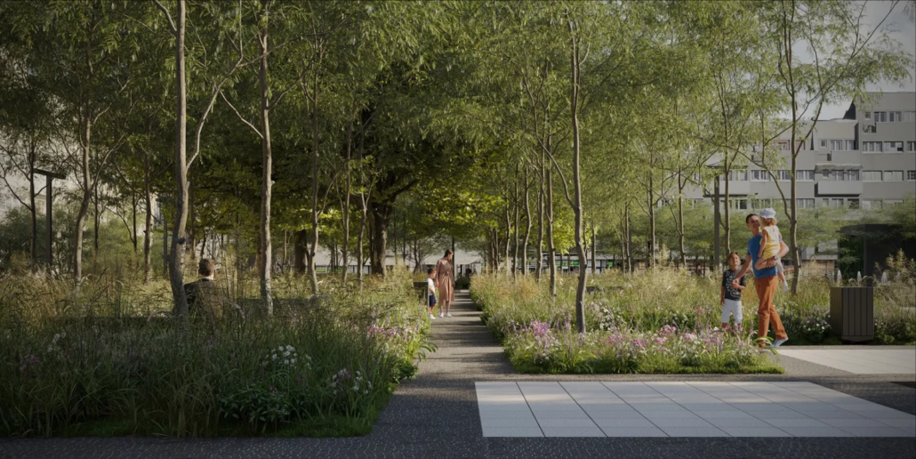
We support cities in effective climate change adaptation. We envision cities of the future — green, resilient and friendly places where blue-green infrastructure becomes the foundation of development and climate protection.
Climate change is and will continue to affect how cities function: heat waves, urban droughts, local flooding and the urban heat island effect are intensifying, resulting in a declining quality of life for residents. European cities today need up-to-date knowledge and universal tools to help them build climate resilience with awareness.
The answer comes from the COOLCITY brand. It offers a set of planning tools based on satellite and aerial data for local governments, helping support effective implementation of adaptive action using nature-based solutions (NBS).
Business model
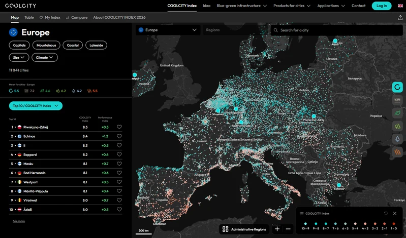
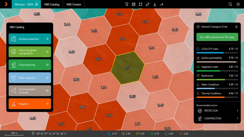
COOLCITY offers complementary tools for local governments: the COOLCITY Index freely available to all EU cities, plus two commercial solutions: COOLCITY View and COOLCITY Design. Each consists of an interactive geoservice with thematic maps and a city space valuation system based on the COOLCITY Index.
The cornerstone of the system is the COOLCITY Index — an integrated indicator measuring the condition of cities’ blue-green infrastructure and their adaptive potential. It is based on five adaptation challenges: surface permeability, vegetation state, biodiversity, water conditions and thermal conditions.
COOLCITY Index
A comprehensive analysis of the adaptive potential of 11,000+ European Union cities. The COOLCITY Index is an interactive platform presenting the climate change adaptation potential of over 11,000 urban areas across Europe. Each city receives a score on a scale of 0–10, enabling measuring, comparing and tracking the blue-green infrastructure in a consistent way. It will be updated annually, providing open access to current data on cities’ condition and resilience.
COOLCITY View: strategic tool
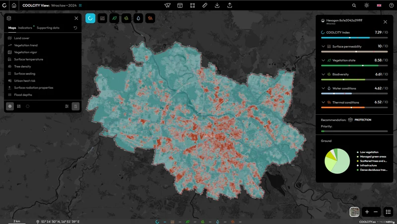
A strategic tool dedicated to local governments at the beginning of their adaptation journey and needing a quick, spatially differentiated diagnosis of the city’s condition and direction-setting recommendations.
- Diagnosis of five adaptation challenges at the scale of the entire city
- Identification of valuable natural assets and problem areas for priority intervention
- Directional recommendations for adaptation actions
- Starting point for urban planning strategies, adaptation plans and local spatial development plans
COOLCITY Design: decision support system
An advanced decision support system providing a detailed city inventory and blue-green solution scenarios for implementation. It precisely assesses the condition of the city’s natural resources and recommends appropriate actions. It allows for modelling of implementation scenarios for NBS and changes associated with new infrastructure.
- City diagnosis based on a detailed and complete inventory of the entire city area carried out using aerial data
- Catalogue of 20+ NBS solutions
- Implementation cost estimation and modelling of improvements in adaptation indicators
- Forecast of ecosystem service growth with valuation based on a choice-experiment study among residents
Challenges and hurdles
Effective city adaptation is a process spanning decades, so the solutions applied must be effective and durable. In working with local governments, we encounter specific obstacles:
- Incomplete or difficult-to-compare data on which adaptation decisions are made at the local level
- Lack of a common methodology for analysing urban environmental resilience that is universal and scalable across Europe
- Low awareness that adaptation requires coordinated work across multiple departments: green spaces, climate, spatial planning, and investment
- Increasing requirements for the consistency of urban adaptation plans with European and national frameworks for climate policy and ecosystem restoration (NRL), combined with the limited institutional resources of cities
- Organisational and financial constraints, particularly in smaller local governments that struggle to obtain current remote sensing data
- Green space management often without current, uniform information on species, distribution and condition of vegetation
Future and opportunities
Our ambition is for COOLCITY to become the European standard for digital climate adaptation support in more than 11,000 cities across the European Union. The tools can be used as a shared framework at all stages of adaptation planning — from BGI inventory, through valuation and planning, to decision-making, implementation and monitoring of outcomes in subsequent years.
Development directions:
- Annual update of the COOLCITY Index platform — tracking changes over time and assessing the effectiveness of adaptive actions
- Supporting European cities required to prepare Urban Adaptation Plans
- Supporting the implementation of EU strategies: Climate Adaptation Strategy, Nature Restoration Law, Mission “100 Climate-Neutral Cities”
- Development of COOLCITY Manager — a tool for daily, comprehensive management of natural resources in urban spaces
By combining reliable data, proven methodology and expert knowledge, COOLCITY helps cities move from problem awareness to effective action — at the scale of Europe and that of a single city and its every street.
The LIFE COOLCITY project (2023–2029) is co-financed by the European Union under the LIFE programme and by the National Fund for Environmental Protection and Water Management. Consortium leader: MGGP Aero. Partners: University of Warsaw, University of Łódź, Sieker, City of Wrocław.
More community stories
NursiTree
Helping trees thrive in changing cities through flexible, relocatable planting systems.
Read the story
Zoometrics
Digital tools helping cities manage community cat colonies humanely and protect urban wildlife.
Read the story
Swarmlab
A digital platform that turns biodiversity measures into manageable, measurable assets.
Read the story
